FORESTRY AN OVERVIEW
INTRODUCTION
The total geographical area of the State is 130,058 km2 which constitutes 3.96% geographical area of the country. It lies between 8°05' N - 13°35' N latitude and 76°15' - 80020' E longitude. Physiographically, the state can be divided into four major regions namely, Coastal Plains, Eastern Ghats, Central Plateau and Higher Elevation Mountains. The south-west monsoon feeds the plateau and the retreating north-east monsoon brings rain to the east coast. The temperature in state ranges from 2°c in the hills to 45°c in other areas. The average rainfall ranges from 925 mm to 1,170 mm.
As per Census 2011, the population of the state is 72.14 million which constitutes 5.96% of the country's population. Rural population constitutes 51.55% and urban population 48.45%. The population density is 555 persons per km2. The livestock population of the state is 30.76 million (Livestock Census 2007).
Land use pattern
Land Use |
Area in ‘000 ha |
Percentage |
Total geographical area |
13,006 |
- |
Reporting area for land utilization |
13,027 |
100.00 |
Forests |
2,106 |
16.17 |
Not available for cultivation |
2,665 |
20.46 |
Permanent pastures and other grazing lands |
110 |
0.84 |
Land under misc. tree crops & groves |
259 |
1.99 |
Culturable wasteland |
333 |
2.56 |
Fallow lands other than current fallows |
1,498 |
11.50 |
Current Fallows |
1,013 |
7.77 |
Net area sown |
5,043 |
38.71 |
Forest Resources
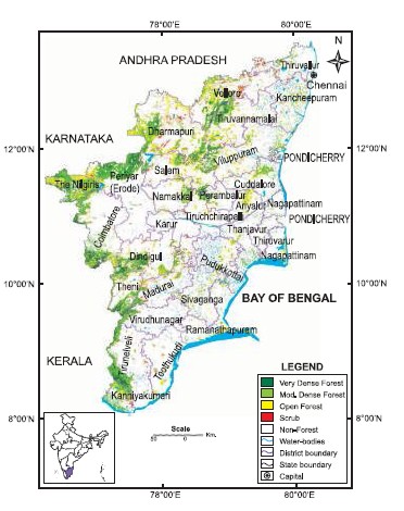
The recorded forests area is 22,877 km², which constitutes 17.59 % of the geographic area of the state. Reserved Forests comprise 84.75 %, Protected forests, 9.54 % and Unclassed Forests, 5.71 %.
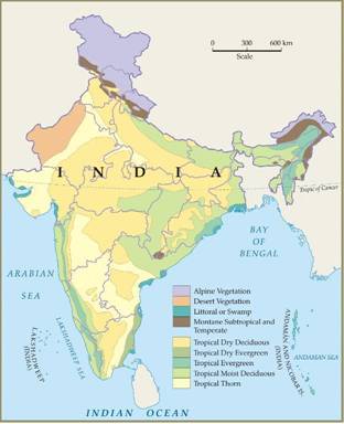
Major forest types occurring in the State are Tropical Wet Evergreen, Tropical Semi-Evergreen, Tropical Moist Deciduous, Littoral and Swamp, Tropical Dry Deciduous, Tropical Thorn, Sub-Tropical Broadleaved and Montane Wet Temperate forests.
Forests represent all actually forested area on the lands classed or administered as forest under any legal enactment dealing with forest, whether state owned or private. The forest area of the state during 05-06 is 21,34000 ha accounting for 16.43% of the total geographical area of the state. Erode district with an extent of 2,28,749 ha under forest is the highest among districts in their contribution to the forest area of the state. This works out to 10.8% of the state’s total forest area. This is followed by krishnagiri district with 2,02,409 ha (9.6%) and Dharmapuri with 1,64,177 ha (7.8%).
The unique feature of the Nilgiris district is that about 56% of the total area of the district is under forests followed by Krishnagiri with 39.4%, Dharmapuri with 36.5%, Kanyakumari with 32.4% and Theni with 32.0%. Erode, Krishnagiri, Dharmapuri, Vellore, Coimbatore, Thiruvannamalai, The Nilgiris, Dindigul, Salem, Thirunelveli and Theni Districts together accounted for 80.1% of the total forest area of the state.
Protected Areas
The state has 5 National Parks and 21 Wildlife Sanctuaries and one Conservation Reserve spread over an area of 3,829.8 km2 which comprises 2.94% of the geographical area. Kalakad Mundanthurai Tiger Reserve, Mudumalai and Mukruti National Park are prominent protected areas. The state has two Biosphere Reserves, namely, Gulf of Mannar and Nilgiris.
Joint Forest Management
The resolution for involving local communities in the management of forests was issued by the Government in 1997 which coincided with the launch of JBIC Project. There are 1,367 JFM Committees managing about 0.48 million ha of forest area as on March 2005, which is about 21% of the forest area of the State. More than 0.24 million families are involved in this programme, of which around 10,000 families belong to the Scheduled Tribes. Water harvesting structures form an important component of the JFM programme. |